Most tourists visit the city of Kyoto for the large number of traditional and historical structures and cultural experiences. However, the city offers plenty of hiking spots for beginners as well as for more experienced hikers. These hiking trails often combine historical Shinto shrines and Buddhist temples with beautiful natural scenic views. In this article we introduce the best hiking trails in and near Kyoto.
1. Fushimi Inari pilgrimage hike
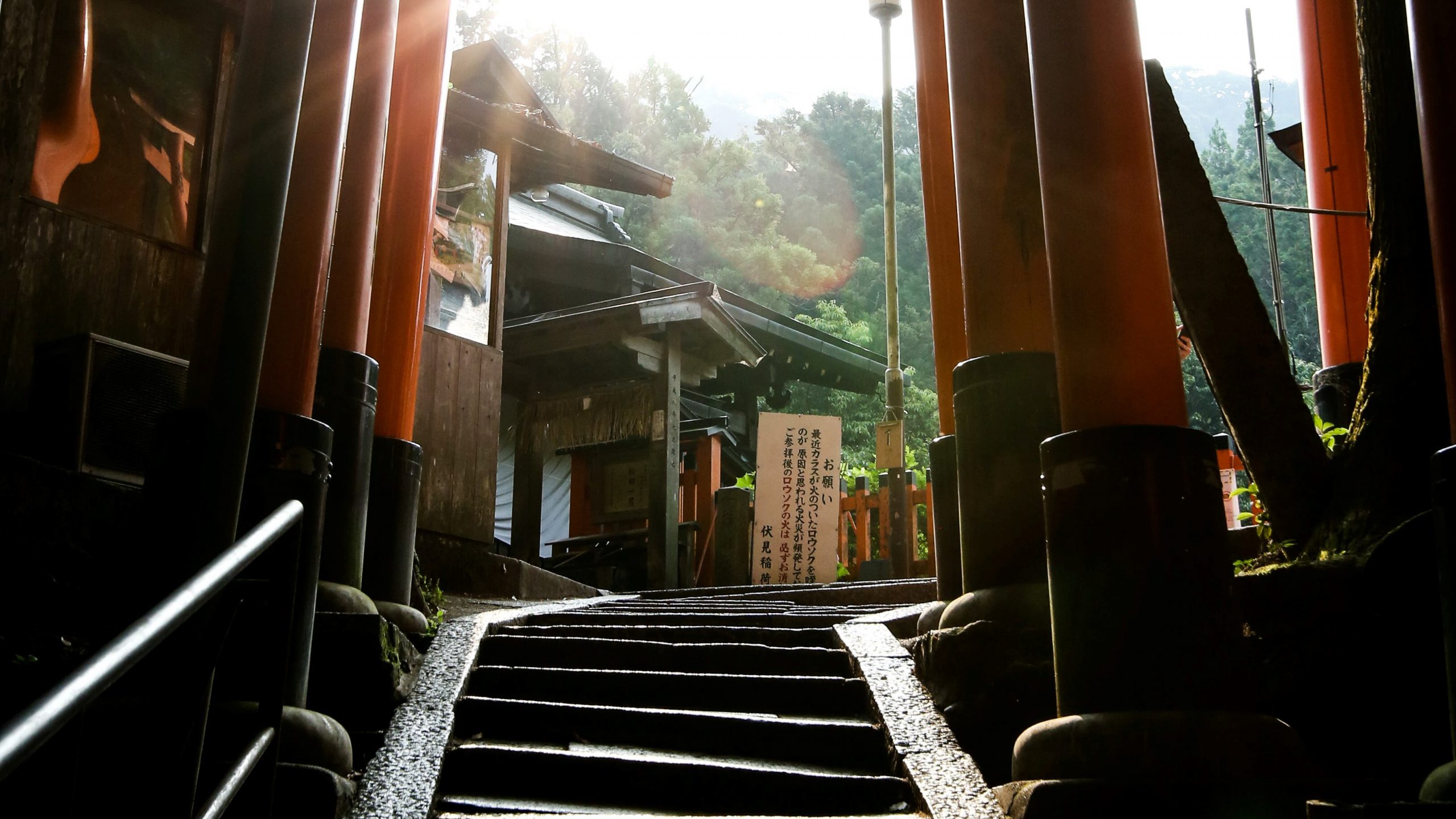
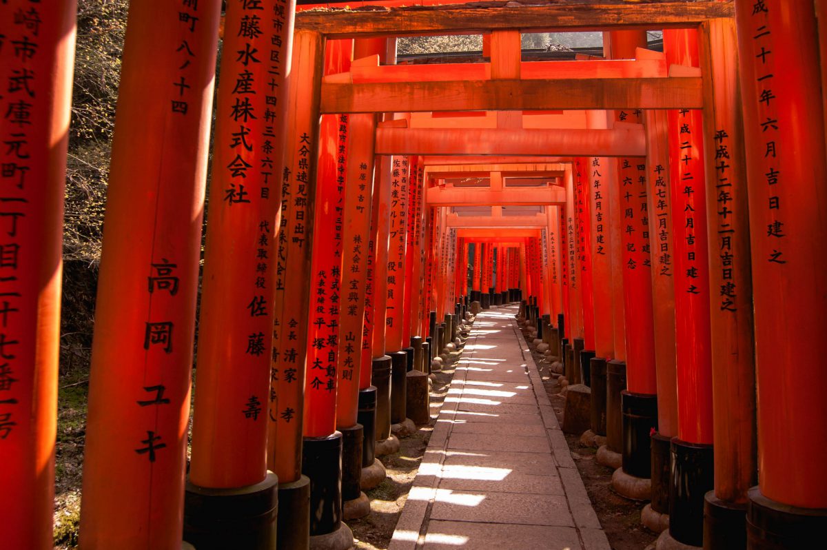
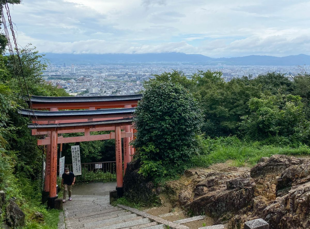
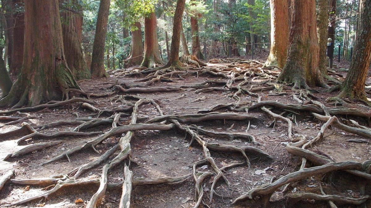
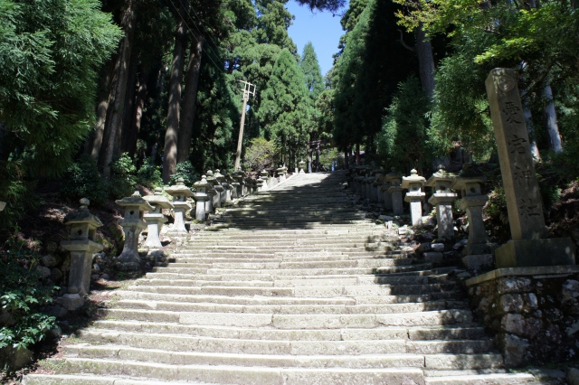
The Fushimi Inari Shrine is the most important of all inari shrines throughout Japan and is one of the most popular spots for tourists. What many people don’t realize is that there is actually a hike leading to the summit of Mt. Inari. The Fushimi Inari pilgrimage hike starts from Inari Station, and goes up near the top of 233-meter Mount Inari-san. The hike to the summit of the mountain and back is about 5 kilometers and takes about 3 hours. Of course the actual time depends on the number of breaks you take for admiring the many interesting sights on the way and taking pictures. The hike involves a fair number of stairs, but it is not too hard if you take it slow. For many parts of the hike, you will be passing through thousands of vermilion torii gates that belong to the Fushimi Inari Shrine. Fushimi Inari Shrine is one of the most popular tourist spots in Kyoto, so the area around the main hall and the lower trails can be very crowded during a day. If you want to avoid large crowds, we recommend you to start hiking early in the morning or even at night, the temple is open 24 hrs.
Level: easy/medium
Length: 5km (roundtrip)
Duration: ~3 hrs
How to get to Fushimi Inari
Inari Station is two stations from Kyoto Station on JR Nara Line.
2. Arashiyama hike
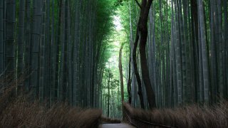
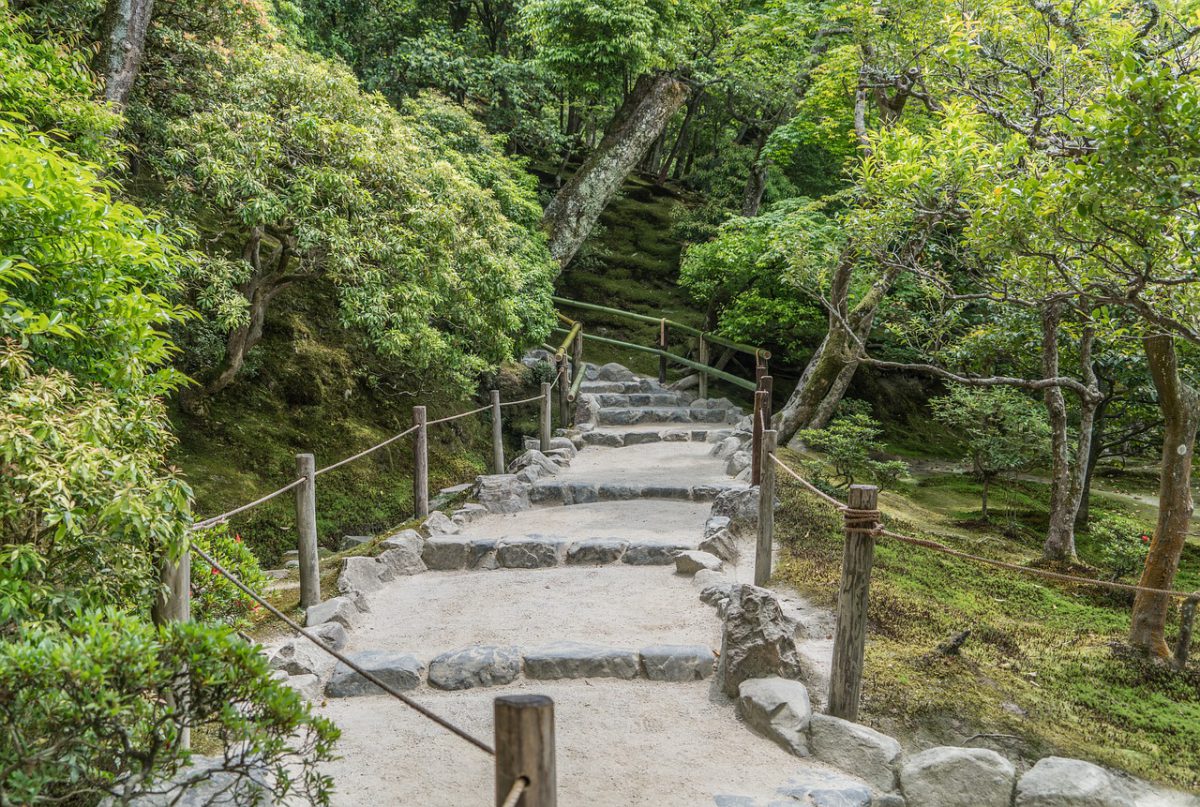
There are several hiking trails that go through Arashiyama. One of the hikes starts from Arashiyama Station on the Arashiyama Main Line, passes Togetsukyo Bridge, the bamboo grove and forests, goes up to Mount Matsuo, and ends at Matsuo-taisha Station on the Arashiyama Main Line. The hike is about 3.3 kilometers and takes about 1.5 hours to complete. The viewpoint just before Mount Matsuo offers great scenic views of Kyoto, Togetsukyo Bridge, and Mount Atago. After descending Mount Matsuo, you will find Saiho-ji Temple, also known as the Moss Temple, which is one of Kyoto’s 17 UNESCO World Heritage Sites. Note: entrance to this temple requires a reservation made well in advance.

Level: easy
Length: 3.3km (roundtrip)
Duration: 1,5 hrs
How to get to Arashiyama
From Kyoto Station, take JR Sagano Line, get off at Saga-Arashiyama Station (~15 mins). Arashiyama Station on the Arashiyama Main Line is about 20 min walking.
3. Daigo-ji Temple, Kami-Daigo hike
Daigo-ji Temple is a large temple complex located southeast of central Kyoto and includes an entire mountainside. Daigo-ji is an important temple of the Shingon sect of Japanese Buddhism and a designated world heritage site. The trail starts from Shimo Daigo (Lower Daigo), which is the present main temple ground at the foot of the mountain, passes sacred springs and man-made waterfalls through the forest, before it reaches Kami Daigo (Upper Daigo). Kami Daigo is the original temple ground located at the summit of the mountain. The trail is about 4 kilometers and takes approximately 3 hours to complete. Because the starting point of the hike is located about 30 minutes south from Kyoto, this is a off-the-beaten track hike that not many tourists do.
Level: medium
Length: 4km (roundtrip)
Duration: 3 hrs
How to get to Daigo-ji Temple
Daigo-ji Temple is a 10 minute walk from Daigo Station.
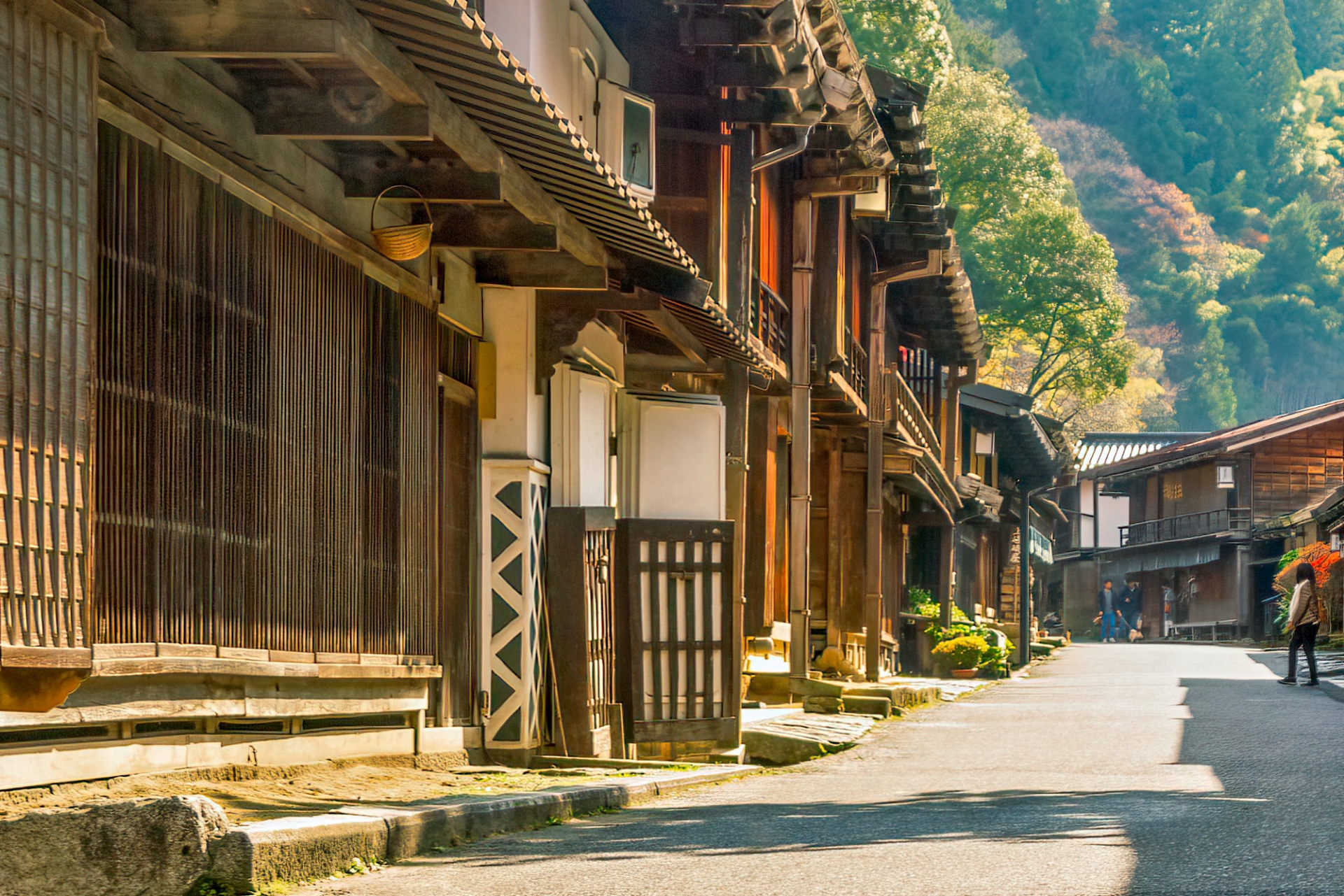
4. Kibune – Kurama hike
Kurama and Kibune are two picturesque little villages in the Kitayama Mountains, north of Kyoto. You can start the hike from Kurama Station and end at Kibune-guchi station or vice versa. Most people start the hike from Kibuneguchi station, make their way up to Kibune Shrine and Kuramadera Temple and finish the hike in Kurama Onsen and take a refreshing dip in the onsen with some amazing views. The hike is about 7 kilometer long and takes about 2 to 3 hours. You can also choose to shorten the hike and take the cable car between Kuramadera Temple and Kurama Onsen. This easy hike is perfect if you want to get out of the city and enjoy some beautiful hiking in the woods. If you are lucky you might even spot some wild deer on the way.
Level: medium
Length: 7km (roundtrip)
Duration: 2-3 hrs
How to get to Kibune or Kurama:
Take the Kurama-bound train to Kibuneguchi Station of Kurama (last station) on the Eizan Railway from Demachiyanagi Station (~20 min). Currently the train between Ichihara and Kurama is suspended because of damage caused by landslides in July 2020, frequent buses are operating between the stations.
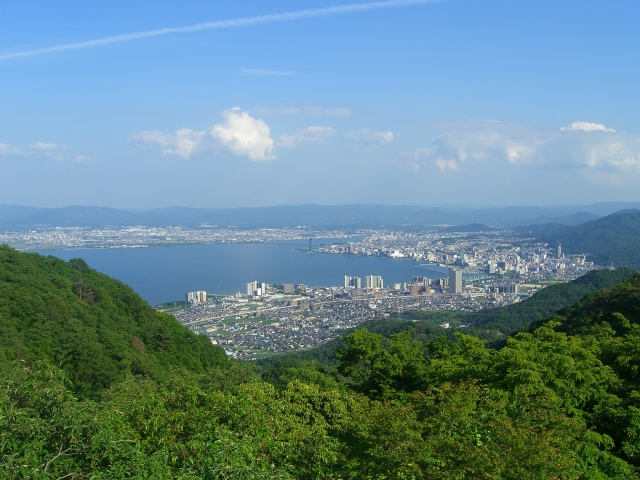
5. Mount Daimonji hike
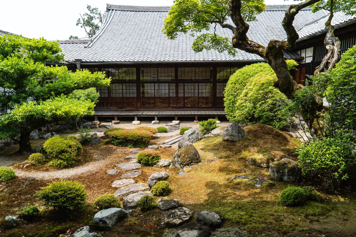
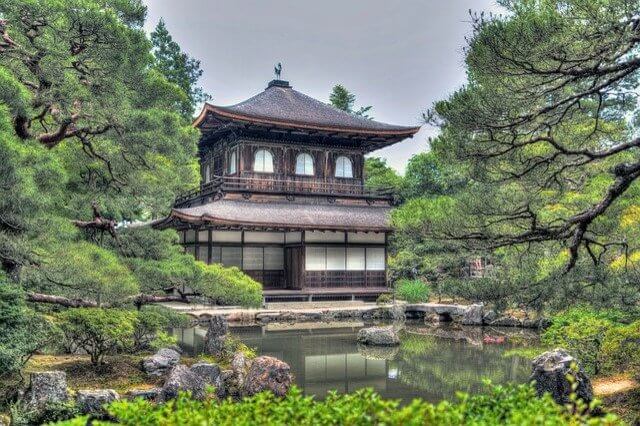
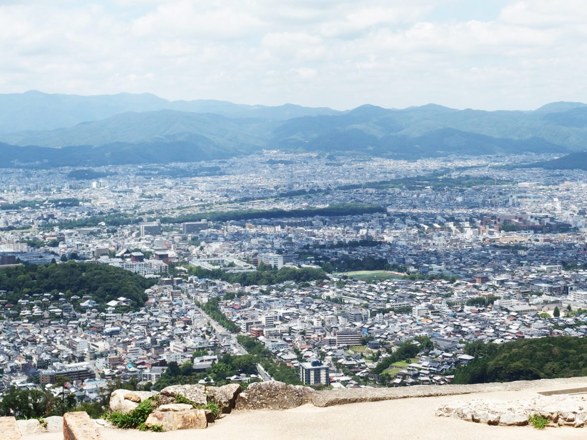
Mount Daimon is a hill located in the northeastern part of Kyoto and offers a superb view of the city. You have several options to reach the top, the most popular one starting at Ginkakuji-temple. The round trip from Ginkaku-ji Temple in Northern Higashiyama up to the top of Mount Daimonji is about 1.5 kilometers, and takes about 1.5 hour to complete. The scenery of the city and surrounding mountains from the viewpoint of Mount Daimonji-yama is breathtaking. It is also an excellent place to enjoy the sunset. The path leads through pleasant woodland and flowing streams. There is a set of steep stairs. If you are in for a longer hike, make your way down to Nanzen-ji Temple, one of Kyoto’s most important temples, famed for its massive front gate and beautiful rock garden. This option will take you about 2-3 hours to complete, depending on your pace and condition.
Level: easy / easy
Length: 3 km (roundtrip) / 5 km
Duration: 1,5 hrs / 2-3 hrs
How to get to the Ginkaku-ji Temple
Take a bus from Kyoto Station, get off at Ginkakuji-michi bus stop or Ginkakuji-mae bus stop (~40 min).
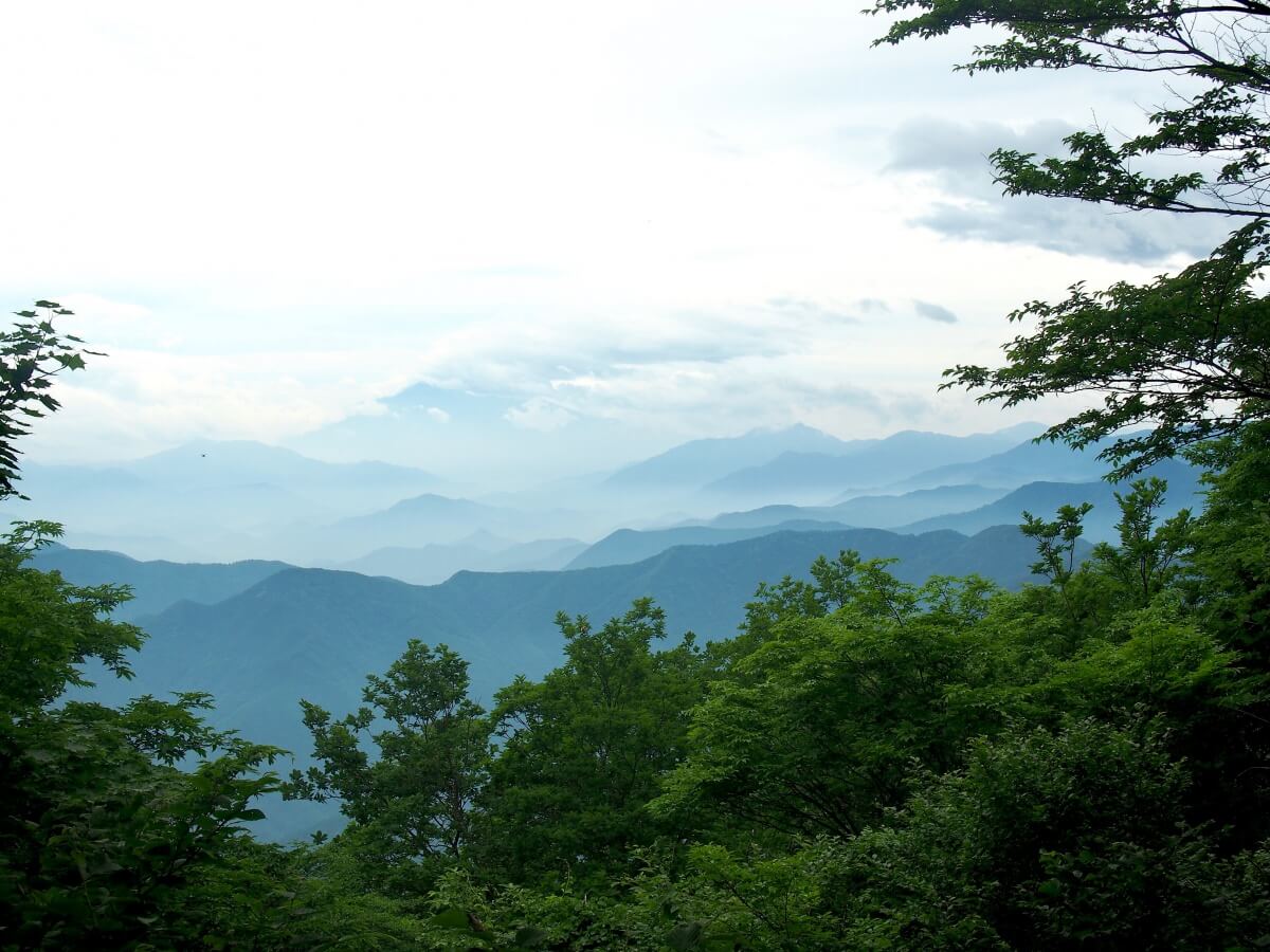
6. Mount Atago hike
Mount Atago, situated on the western side of the city not far from Arashiyama, is the highest peak of the mountain range surrounding Kyoto. This 924 meter high mountain is a very popular day hike for the residents of Kyoto and the surrounding areas. It is about 4 kilometers to the top of the mountain, and a round trip will take about 4 to 5 hours. The hiking route is also a pilgrimage route, and Atago Shrine located at the top of Mount Atago is the head shrine of all Atago shrines across the country which are dedicated to an important Shinto deity.
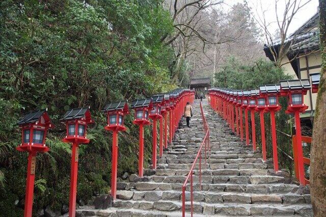
Every year from the night of July 31 through to the morning of Aug. 1, a huge number of pilgrims can be found on Mount Atago. It is believed that after making the trip, you will be granted “1,000 days’ worth of protection against fire-related disasters.” While the pilgrimage takes place, Mount Atago is host to Sennichi Tsuyasai, a festival at Atago Shrine that is all about fire, both good and bad. Lanterns are lit all along the route to guide hikers to the summit in the darkness.
Level: medium
Length: 8km (roundtrip)
Duration: 4-6 hrs
How to get to Mount Atago:
Take a bus at either Hankyu or Randen Arashiyama Station and get off at the final bus stop, Kiyotaki (~25 min).
7. Lake Biwa – Uminobo no Michi hike
There are several hiking routes around Lake Biwa, the largest lake in Japan located in the Shiga Prefecture north of Kyoto. Uminobe no Michi (Lakeside Path) stretches about 140 kilometers along a small mountain range north of Lake Biwa. This hiking route has good access from either Kyoto or Osaka.
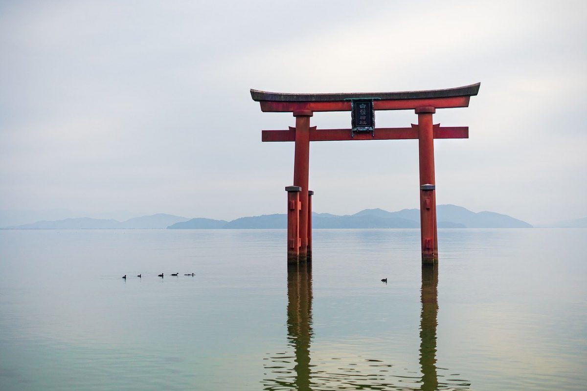

There are a couple of ways to approach Uminobe no Michi hike depending on your transport preference and physical fitness level. Probably the most popular hike starts from JR Yogo Station which is situated north of Lake Biwa, passes by Lake Yogo, and heads south along Lake Biwa to Yamamotoyama Tozan-guchi bus stop, from where you can take Kohakucho Bus to JR Kawake Station. The hike is about 13 kilometers and takes approximately 7 hours. There are fairly steep ups and downs along the trail, so make sure to wear decent hiking footwear.
Level: medium
Length: 13km (roundtrip)
Duration: 7 hrs
How to get to Uminobe no Michi:
From Kyoto Station, take JR Tokaido Shinkansen to Maibara Station, then take JR Hokuriu Honsen Express and get off at Yogo Station (~1 hr).
What did you think about our list of hiking trails in and near Kyoto? Although Kyoto offers plenty of historically and culturally interesting spots for tourists, hiking in beautiful nature can be another option for a relaxing and refreshing day. It offers you a chance to actively explore the beautiful mountain range surrounding the city of Kyoto.
Happy traveling!
Articles you may also like


This post may contain some affiliate links. When you click through and make a purchase we may receive some commission, at no extra costs to you.